We are pleased to present the collection of book dealer Paul Bentley (1931-2022) in our upcoming 10 October Books & Maps Sale, including a copy of the most famous British atlas of the 17 century.
22 September 2023
VIEW AUCTION REQUEST A VALUATION CONTACT A SPECIALIST
Paul Bentley, who grew up in wartime London had enjoyed some success in the advertising industry as a copywriter. But he had always loved maps, landscapes and walking, and in the 1970s he left the office behind to set up in business with his wife, Mary dealing in antiquarian books and maps. He became a recognised specialist in the field and his research is credited in both James Howgego’s Printed Maps of London 1553-1850 and Ralph Hyde’s Printed Maps of Victorian London 1851-1900.
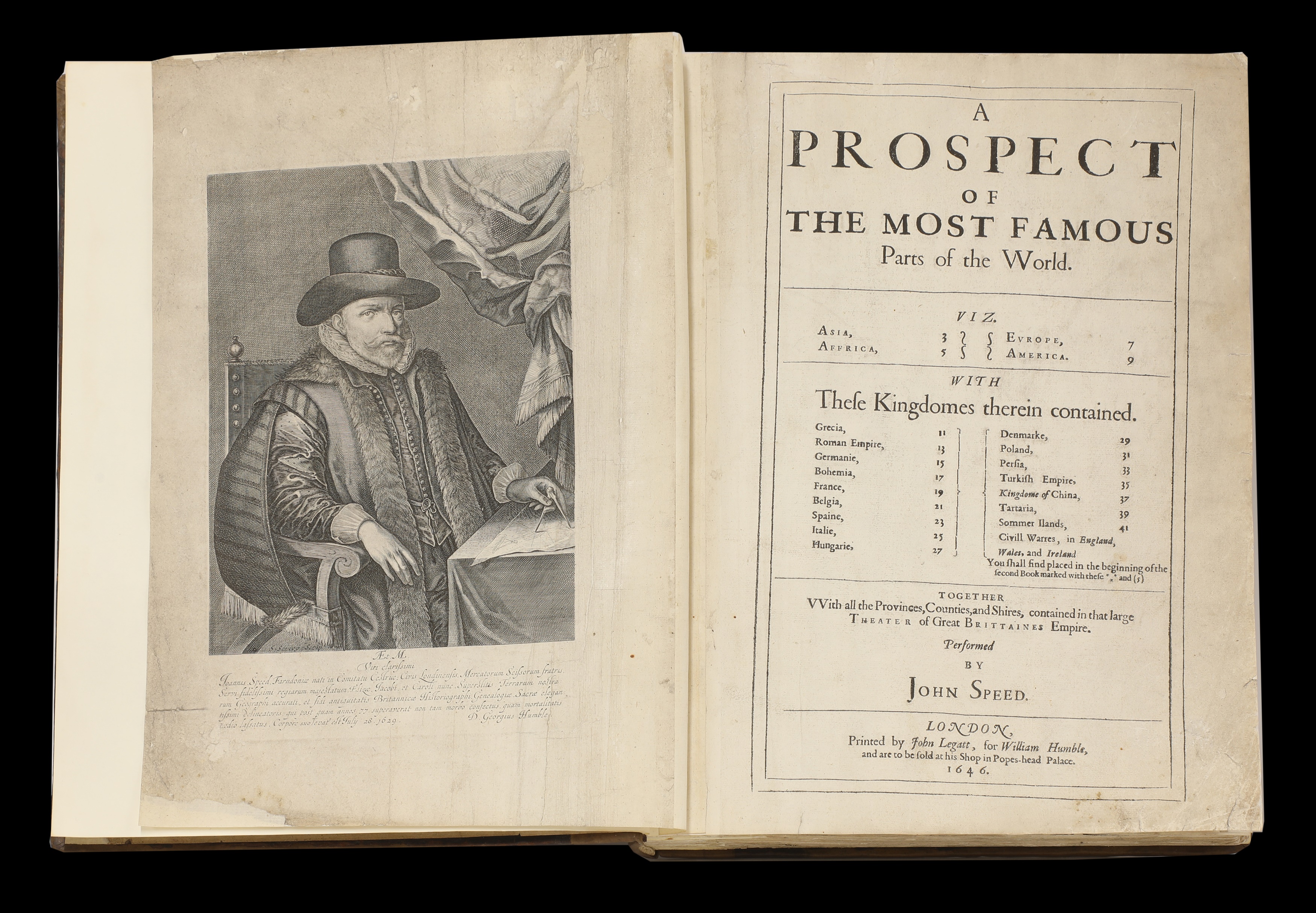
ATLASES: Speed (John) (£10,000-15,000)
Paul Bentley bought his complete copy of John Speed’s celebrated atlas Prospect of the Most Famous Parts of the World, quite cheaply in the late 1960s in poor condition. At the time most copies were being broken up for their plates. However, it was later painstakingly restored over many months by one of his contacts at the British Museum. A copy printed in The Commonwealth period c.1646-50, it carries an estimate of £10,000-15,000 on October 10.
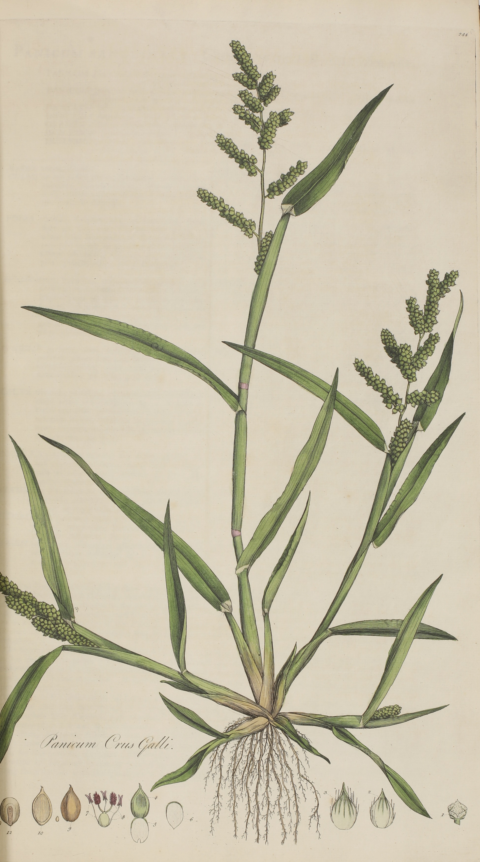
CURTIS, William: Flora Londinensis: or Plates and Descriptions of such plants as grow wild in the Environs of London (£1,500-2,500)
One of the great English botanical books of the following century is Flora Londinesis by William Curtis, a folio-sized book published in parts between 1777-98 that describes the botany found in and around London in the 1700s. The copy owned by Bentley, in three leather-bound volumes, is estimated at £5,000-7,000.
Previous works on the flora of Britain had been intended for scientists, apothecaries, and herbalists, but Curtis (the director at the Chelsea Physic Garden) wrote for the general reader. He commissioned several painters to produce the hand-coloured copper engravings to assist in the identification of a species.
![ATLASES: [BERTIUS, Petrus (1565-1629)]. Tabularum geographicarum contractarum libri septem (£5,000-7,000)](https://sworders.blob.core.windows.net/blogs-2023/Paul Bentley - Blog - Sept 2023 - Image 5.jpg)
ATLASES: [BERTIUS, Petrus (1565-1629)]. Tabularum geographicarum contractarum libri septem (£5,000-7,000)
A copy of the 17 century pocket atlas A Tabularum Geographical Contractarum Libri Septem is guided at £5,000-7,000. Cartographer Petrus Berties (1565-1629), professor of mathematics and librarian at the University of Leiden, engraved 169 maps for the project and provided the Latin text. It ran to ten editions between 1600-50 with this copy (seven parts bound in one volume).
To view all lots from the collection of Paul Bentley (1931-2022) please click here

rarebooks@sworder.co.uk | 01279 817778
On Tuesday 14 July, Sworders London were pleased to host a breakfast and private tour of the exhibition Hepworth in Colour at The Courtauld Gallery.
27 July 2026
We are delighted to share our Old Master, British & European Art department's recent successes, including a focus on women artists and rediscoveries.
22 July 2026
This November, Sworders is pleased to present Tastemakers: Modern and Contemporary Art & Design, a landmark auction dedicated to the artists, designers, makers, collectors and patrons who have shaped visual culture throughout the twentieth and twenty-first centuries.
22 July 2026